Sandy bringing clouds, winds to Midlands
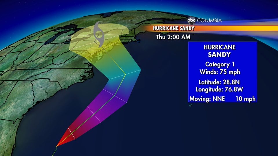
COLUMBIA, S.C. (WOLO) — While officials in New York and the northeast portion of the nation are cautiously watching what could be a very serious weather situation, Sandy is scraping by the coast of South Carolina. Tropical Storm Watches are in effect for coastal counties from Charleston southward to Beaufort, while Tropical Storm Warnings are in effect from Charleston northward along the Grand Strand. The Midlands is experiencing clouds and breezy conditions. A Lake Wind Advisory is in effect for the entire area until 10 p.m. Sunday night. There is only about a 20% chance of a shower this afternoon. The best chance of more serious conditions is along the South Carolina coast, where Tropical Storm-force winds and heavy rains are expected east of I-95. A cold front that will push eastward Sunday will help continue to divert Sandy away from the Carolinas, but behind it will be a very cold air mass that will yank temperatures down into the 60s by Monday, and lows will be in the 30s by Tuesday morning. Officials in the northeast are concerned that Sandy will weaken into an extratropical system and combine with the powerful cold front, creating a scenario where strong winds, heavy rains, and even lots of snow stretching from Maine down into Virginia and even North Carolina. Computer models have continued to indicate that landfall is going to be at the New Jersey-Delaware border, meaning the Big Apple is looking at the brunt of the storm with lots of strong winds and rain from Sandy.